Search
Search Results
-
Urban surface classification using semi-supervised domain adaptive deep learning models and its application in urban environment studies
High-resolution urban surface information, e.g., the fraction of impervious/pervious surface, is pivotal in studies of local thermal/wind...

-
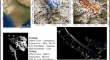
Classification of glacier with supervised approaches using PolSAR data
Glacier comprises distinct features (snow, ice, and debris cover) and their identification and classification using satellite imagery is still a...
-
Investigation of changes in land use/land cover using principal component analysis and supervised classification from operational land imager satellite data: a case study of under developed regions, Pakistan
Monitoring and understanding Land Use/Land Cover (LU/LC) is critical for sustainable development, as it can impact various environmental, social, and...

-
Semi-supervised deep learning based on label propagation algorithm for debris flow susceptibility assessment in few-label scenarios
Regional debris flow susceptibility assessment is an effective method to prevent debris flow hazards, and deep learning is emerging as a novel...

-
Landslide susceptibility assessment based on frequency ratio and semi-supervised heterogeneous ensemble learning model
Epistemic uncertainty in data-driven landslide susceptibility assessment often tends to be increased by the limited accuracy of an individual model,...

-
Landslide susceptibility prediction improvements based on a semi-integrated supervised machine learning model
Differences in model application effectiveness, insufficient numbers of disaster samples, and unreasonable selection of non-hazard samples are common...

-
Spatio-temporal analysis of land use/land cover change detection in small regions using self-supervised lightweight deep learning
Change detection (CD) has sparked a lot of scientific interest in recent decades as one of the core concerns in Earth observation. The enhancement of...

-
Optimizing identification of mine water inrush source with manifold reduction and semi-supervised learning using improved autoencoder
To enhance the accuracy of identifying water sources in mine inrush incidents, this study, taking the Shengquan coal mine in Shandong, China, as a...

-
A semi-supervised approach of short text topic modeling using embedded fuzzy clustering for Twitter hashtag recommendation
Social media stands as a crucial information source across various real-world challenges. Platforms like Twitter, extensively used by news outlets...

-
Comparison of computer vision models in application to pollen classification using light scattering
This study investigates the use of pollen elastically scattered light images for species identification. The aim was to identify the best recognition...

-
A Hybrid Approach of Supervised Self-organizing Maps and Genetic Algorithms for Predictive Map** of Arsenic Pollution in Groundwater Resources
Arsenic is a toxic heavy element that can cause a wide range of diseases, including cancer, when present in high concentrations in drinking water....

-
Enhancing natural disaster analysis and waste classification: a novel VGG-FL approach
The study of natural disasters is a crucial field that involves analyzing the occurrence, impact, and aftermath of various natural hazards that can...

-
An integrated deep-learning model for smart waste classification
Efficient waste management is essential for human well-being and environmental health, as neglecting proper disposal practices can lead to financial...

-
Hydrogeochemical characterization of the groundwater of Lahore region using supervised machine learning technique
The cationic and anionic composition in groundwater can be better understood by identifying the type of hydrogeochemical processes influencing...

-
Comparison of general kernel, multiple kernel, infinite ensemble and semi-supervised support vector machines for landslide susceptibility prediction
Landslide susceptibility prediction is a key step in preventing and managing landslide hazards. As a classical supervised non-parametric machine...

-
Development of entropy-river water quality index for predicting water quality classification through machine learning approach
Monitoring of river water is necessary to reveal its quality and pollution level so that we can protect human health and the environment. The present...

-
Dimensionality reduction strategies for land use land cover classification based on airborne hyperspectral imagery: a survey
Hyperspectral image (HSI) contains hundreds of adjacent spectral bands, which can effectively differentiate the region of interest. Nevertheless,...

-

-
Classification Model of Pesticide Toxicity in Americamysis bahia Based on Quantum Chemical Descriptors
A set of quantum chemical descriptors (molecular polarization, heat capacity, entropy, Mulliken net charge of the most positive hydrogen atom, APT...

-
Accurate classification of land use and land cover using a boundary-specific two-level learning approach augmented with auxiliary features in Google Earth Engine
Land use land cover (LULC) classification using remote sensing images is a valuable resource in various fields such as climate change, urban...
