Search
Search Results
-
Reservoir bathymetry and riparian corridor assessment in two dammed sections of the Teesta River in Eastern Himalaya
As of mid-2021, four hydroelectric dams are operational on the main channel of the Teesta River in the mountainous and tectonically active...

-
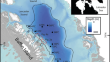
Future changes in Antarctic coastal polynyas and bottom water formation simulated by a high-resolution coupled model
Antarctic coastal polynyas produce Dense Shelf Water, a precursor to Antarctic Bottom Waters that supply the global abyssal circulation. Future...

-
High-Resolution In Situ Characterization of the Hydrochemical Variability Along the Fluvio-marine Transition of the Río de la Plata Estuary, Argentina
Estuaries are characterized by steep biogeochemical gradients that are often overlooked by discrete water sampling which is especially critical for...

-
Spatiotemporal high-resolution map** of biological production in the Southern Ocean
The Southern Ocean is considered to play an important role in the global biogeochemical cycles of carbon and nutrients. It is still unclear how...

-
Influences of Tides, Winds, and Bathymetry on Surface Transport Through a Complex Nearshore System: Measurements from GPS Drifters and an Uncrewed Aerial Vehicle
Bathymetric features such as dredged channels, constricted-inlet basins, and nearshore islands have known influences on coastal transport, which are...

-
Southern Ocean pinnipeds provide bathymetric insights on the East Antarctic continental shelf
Poor coverage of the Antarctic continental shelf bathymetry impedes understanding the oceanographic processes affecting Antarctica’s role in global...

-
Coastal Vegetation and Bathymetry Influence Blue Crab Abundance Across Spatial Scales
Blue crabs ( Callinectes sapidus ) are highly mobile, ecologically-important mesopredators that support multimillion-dollar fisheries along the western...

-
Extracting Water Depth from Landsat-8 Multispectral Satellite Imagery in Coastal Waters
Bathymetric data generates nautical charts, seafloor profiles, biological oceanography, etc. Water depth is collected using active sensors like...
-
Characteristics of submerged and partially submerged caves (habitat type 8330) in Romania
Underwater sea caves form a relatively under-examined habitat type within the marine regions of Europe, although they provide unique physical...

-
Identification and map** of Algerian island vegetation using high-resolution images (Pléiades and SPOT 6/7) and random forest modeling
Despite their proximity to the coast, few studies have focused on identifying and map** the vegetation of Algerian islands and islets. To fill this...

-
Combining Low-Cost Sonar and High-Precision Global Navigation Satellite System for Shallow Water Bathymetry
Periodic bathymetry surveys are essential to provide data to keep navigation charts updated, obtain insights into water body bottom dynamics and...

-
The Suitability of Electrode Measurements for Assessment of Benthic Organic Impact and Their use in a Management System for Marine Fish Farms
A management system for marine fish farms in Norway has recommended the use of simple electrode measurements of redox potentials (E...
-
Seafloor roughness reduces melting of East Antarctic ice shelves
Heat delivered by the ocean circulation is melting the Antarctic ice sheet from below. This melt is largest where warm Circumpolar Deep Water...

-
Assessing Tidal Hydrodynamics in a Tropical Seascape Using Structure‐from‐Motion Photogrammetry and 2D Flow Modelling
Tidal wetlands continue to be threatened by changes in seascape hydrological regime and connectivity resulting from human activities (e.g....

-
Application of deep learning to large scale riverine flow velocity estimation
Fast and reliable prediction of riverine flow velocities plays an important role in many applications, including flood risk management. The shallow...

-
Coastal vulnerability assessment for the coast of Tamil Nadu, India—a geospatial approach
A coastal region is a section of land that borders a significant body of water, often the sea or ocean. Despite their productivity, they are...

-
Evidence for an extensive ice shelf in northern Baffin Bay during the Last Glacial Maximum
The glaciological significance of ice shelves is relatively well established for the stability of modern ice sheets of Antarctica. Past ice shelves...
-
Vessel-Based, Shallow Water Map** with a Phase-Measuring Sidescan Sonar
Coastal areas have traditionally been difficult locations to collect consistent, high-resolution bathymetric data via vessel-based acoustic surveys....

-
Map** the susceptibility of reefs to rubble accumulation across the Great Barrier Reef
Disturbance-induced rubble accumulations are described as “killing fields” on coral reefs as coral recruits suffer high post-settlement mortality,...

-
Numerical Investigation of River Discharge and Tidal Variation Impact on Salinity Intrusion in a Generic River Delta Through Idealized Modelling
Salinity in deltaic systems is expected to increase in the near future due to sea level rise. This will cause severe environmental consequences...
