Search
Search Results
-
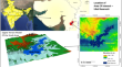
Automatic extraction of highly risky coastal retreat zones using Google earth engine (GEE)
Coasts have been used for settlement, agriculture, transportation, recreation, defense and trade as areas that have attracted human beings for...

-
Assessment of forest fire emissions in Uttarakhand State, India, using Open Geospatial data and Google Earth Engine
In the recent past, forest fires have increased due to the changing climate pattern. It is necessary to analyse and quantify various gaseous...

-
Near real-time flood inundation and hazard map** of Baitarani River Basin using Google Earth Engine and SAR imagery
Flood inundation map** and satellite imagery monitoring are critical and effective responses during flood events. Map** of a flood using optical...

-
Characterizing land use/land cover change dynamics by an enhanced random forest machine learning model: a Google Earth Engine implementation
Land use and land cover (LULC) analysis is crucial for understanding societal development and assessing changes during the Anthropocene era....

-
Suspended Particulate Matter Analysis of Pre and During Covid Lockdown Using Google Earth Engine Cloud Computing: A Case Study of Ukai Reservoir
Presence of suspended particulate matter (SPM) in a waterbody or a river can be caused by multiple parameters such as other pollutants by the...
-
Estimating turbidity concentrations in highly dynamic rivers using Sentinel-2 imagery in Google Earth Engine: Case study of the Godavari River, India
Turbidity is an essential biogeochemical parameter for water quality management because it shapes the physical landscape and regulates ecological...

-
Flood map** and damage assessment due to the super cyclone Yaas using Google Earth Engine in Purba Medinipur, West Bengal, India
This study maps flood inundation and estimates the damage caused by super cyclone Yaas in Purba Medinipur, India. We used Google Earth Engine (GEE)...

-
Monitoring spatio-temporal changes in wetlands with harmonized image series in Google Earth Engine
Study of rapidly changing lakes and wetlands with remote sensing methods is critical for understanding the climatic and anthropogenic effects....

-
Empowering real-time flood impact assessment through the integration of machine learning and Google Earth Engine: a comprehensive approach
Floods cause substantial losses to life and property, especially in flood-prone regions like northwestern Bangladesh. Timely and precise evaluation...

-
Spatiotemporal statistical analysis of water area changes with climatic variables using Google Earth Engine for Lakes Region in Türkiye
In this study, trend analysis of the lake surface areas was performed on the Google Earth Engine (GEE) platform in the period of 1985–2022 with...

-
Understanding the linkages between spatio-temporal urban land system changes and land surface temperature in Srinagar City, India, using image archives from Google Earth Engine
Land-use and land-cover (LULC) is an important component for sustainable natural resource management, and there are considerable impacts of the rapid...

-
Analytical hierarchy process tool in Google Earth Engine platform: a case study of a tropical landfill site suitability
Kolkata being a metropolitan city in India has its main municipal solid waste dumpsite situated at Dhapa just adjacent to the East Kolkata Wetlands...

-
Soil Erosion Assessment by RUSLE, Google Earth Engine, and Geospatial Techniques over Rel River Watershed, Gujarat, India
The assessment of soil erosion holds paramount significance in sustainable land management and environmental conservation. In this context, the...
-
Develo** a method for assessing environmental sustainability based on the Google Earth Engine platform
Environmental sustainability is the foundation and of great significance for the sustainable development of urban agglomerations. Taking the...

-
A national-scale assessment of land use change in peatlands between 1989 and 2020 using Landsat data and Google Earth Engine—a case study of Ireland
Over the centuries, anthropogenic pressure has severely impacted peatlands on the European continent. Peatlands cover ~ 21% (1.46 Mha) of Ireland’s...

-
Lake dynamics in Tibetan Plateau during 1990–2020 and exploratory factor analyses using Google Earth Engine
Tibetan Plateau (TP) lakes are crucial water resources for many countries, and the region is sensitive to climate change, so the TP lakes’ dynamics...

-
Changes in NO2 and O3 levels due to the pandemic lockdown in the industrial cities of Tehran and Arak, Iran using Sentinel 5P images, Google Earth Engine (GEE) and statistical analysis
Air pollution has very damaging effects on human health. In recent years the Coronavirus disease (COVID-19) pandemic has created a worldwide economic...

-
Automated delineation of salt-affected lands and their progress in coastal India using Google Earth Engine and machine learning techniques
Assessment of salt-affected land (SAL) is still a major challenging task worldwide, especially in develo** nations. The advancement of remotely...

-
Extreme rainfall-induced urban flood monitoring and damage assessment in Wuhan (China) and Kumamoto (Japan) cities using Google Earth Engine
Floods in urban areas result in a detrimental impact on the natural environment and human health and pose major risks to assets and communication...

-
Paddy Rice map** in fragmented lands by improved phenology curve and correlation measurements on Sentinel-2 imagery in Google earth engine
Accurate and timely rice crop map** is important to address the challenges of food security, water management, disease transmission, and land use...
