Search
Search Results
-
Develo** a volunteered geographic information-based system for rapidly estimating damage from natural disasters
When it comes to crisis management in times of earthquake, a large volume of damage information is required in the first hours in order to reduce its...

-
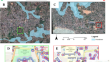
Disaster management with cloud-based geographic information systems: site selection of landfill areas after Kahramanmaraş, Türkiye earthquake sequence
On February 6, 2023, the earthquakes centered on Kahramanmaraş-Pazarcık and Kahramanmaraş-Elbistan affected several provinces in the region and...

-
Tourism Environmental Impact Evaluation Framework (TEIEF): Using VGI Data to Assess the Ecological Impact of Tourism in the Danxiashan UNESCO Global Geopark of China
Geoparks play a vital role in safeguarding unique landscapes, but the surge in tourist activity in these areas has raised concerns regarding their...

-
Rapid natural hazard extent estimation from twitter data: investigation for hurricane impact areas
Natural hazards have occurred more frequently in the past years and pose a severe risk to human life. Their extents and, thereby, the most heavily...

-
Qualitative and quantitative metrics for the visual description of landscapes in a volunteered geographical information environment
A landscape generally consists of both natural and human-made elements of a land area. Human representations of landscapes can cover a wide range of...

-
A progressive development of a visual analysis interface of climate-related VGI
This paper describes the progressive development of three approaches of successively increasing analytic functionality for visually exploring and...

-
Reliability extracted from the history file as an intrinsic indicator for assessing the quality of OpenStreetMap
Volunteered geographic information (VGI) is a large and up-to-date data source, which is available to the public easily. VGI enables public...

-

-
A geographic meta-database of caves and underground structures in Turkey
Caves and underground structures are voids that can be natural or man-made. Besides this geological meaning, these voids, with peculiar environmental...

-
Map** cultural ecosystem services in mountain forests using mobile phone data
The aim of the work was to determine the spatial distribution of activity in the forest on the area of the Forest Promotional Complex “Sudety...
-
Map** and characterising buildings for flood exposure analysis using open-source data and artificial intelligence
The map** and characterisation of building footprints is a challenging task due to inaccessibility and incompleteness of the required data, thus...
-
Estimating building occupancy: a machine learning system for day, night, and episodic events
Building occupancy research increasingly emphasizes understanding the social and physical dynamics of how people occupy space. Opportunities in the...

-
Big Data in Geophysics and Other Earth Sciences
Abstract —The term “Big Data” has become very popular over the past decade. The frequency of its use in the research papers, reports, and broad press...

-
Detecting Vegetation Regrowth After Fires in Small Watershed Settings Using Remotely Sensed Data and Local Community Participation Approach
The purpose of this paper is to present an operational framework to detect vegetation regrowth after fires and implement alternative income options...
-
Meta ensemble learning in geospatial sentiment analysis and community survey map**: a water supply case study
Amidst the proliferation of social media and online platforms, sentiment analysis stands out as a pivotal tool in Natural Language Processing (NLP),...

-
Utilizing Geo-Social Media as a Proxy Data for Enhanced Flood Monitoring
Social media plays an important role in disseminating spontaneous information during natural disasters/emergencies. It is a crowdsourcing platform,...

-
Bias-correction data of IFS rainfall forecasts for hydrological and hydraulic models to forecast flood events
Rainfall input from the Integrated Forecasting System (IFS) to improve flood forecasting quality plays an important role when it was tested for the...

-
Utilising Twitter for disaster management of fire events: steps towards efficient automation
The present article introduces a novel method for processing and visualising information linked to fire events, from Twitter, which is utilised as a...

-

-
Social Media in Risk Perception and Disaster Management: A Geographical Perspective
The advent of the last Technological Revolution has completely upset long-entrenched relations among spaces, places and communication flows, by...