Search
Search Results
-
The Structural Zoning of the African–Antarctic Sector of the Southern Ocean Based on the Analysis of Anomalous Gravity and Magnetic Fields
AbstractThe African–Antarctic sector of the Southern Ocean is the least studied part of the World Ocean; its structure and evolution of the...

-
Fuzzy Sets of High Seismicity Intersections of Morphostructural Lineaments in the Caucasus and in the Altai–Sayan–Baikal Region
AbstractThe article is devoted to earthquake-prone areas recognition with M ≥ 6.0 in the Caucasus and in the Altai–Sayan–Baikal region. A new...

-
Local tsunamigenic sources in Greece, identified by pattern recognition
This study is an attempt to determine potential tsunamigenic morphostructural nodes in Greece using pattern recognition algorithms. The earthquakes...

-
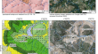
Satellite Geological Indication of Morphostructural Elements of the Coasts and Bottom of Adjacent Water Areas (Peter the Great Bay, Sea of Japan)
AbstractThe implementation of satellite geological investigations within the continent–Sea of Japan transition zone in Southern Primorye has made it...

-
Seismicity Modeling in Tasks of Seismic Hazard Assessment
AbstractThe main disadvantages of selected elements of seismicity modeling for composing the General Seismic Zoning maps are considered in the...

-
Active fault characterization and seismotectonic zoning of the Hispaniola island
Designing a seismic source model based on the most complete description of potentially active faults and on the kinematics of their latest movements...

-
Determination of Seismogenic Zones for Analysis of Seismotectonic Activity of Deep Faults: Seismic Hazard Assessment for the Territory of Azerbaijan
Abstract —Seismic zoning maps of Azerbaijan, compiled using the genetic (seismotectonic) method, are analyzed. The peculiarities of this method are...

-
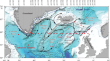
Seafloor Surface Sediments of the North Atlantic on the Profile Along 59.5° N
Abstract—Analysis of the lithological, isotope-geochemical, and micropaleontological parameters of the surface layer of bottom sediments in the North...
-
Morphodynamics and Morphotectonics of the Varzuga River Estuary Area in the Late Glacial and Holocene (Terskiy Coast of the White Sea)
AbstractThe late-glacial and post-glacial history of the development of the White Sea coastal zone in the area of the Varzuga River estuary is...

-
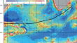
Tectonic Structure and Evolution of the Lithosphere in the Near-Antarctic Part of the South Atlantic
AbstractBased on an analysis of global digital models, the distribution of fracture zones of the oceanic crust, global and regional models of...
-
Stratigraphy of Cenozoic Deposits and the History of the Latest Stage of Geological Development of the Zaisan Depression (Eastern Kazakhstan)
AbstractThe Zaisan Depression is a unique geological structure that preserves the most complete sedimentary record of the Late Mesozoic and most of...

-
Assessment of Initial Seismicity for Offshore Platforms: a Case Study of the Pechora Sea
AbstractSeismotectonic and seismoacoustic studies carried out during an expedition onboard the R/V Akademik Boris Petrov in the Pechora Sea revealed...

-
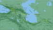
High Seismicity Intersections of Morphostructural Lineaments: The Black-Sea–Caspian Region
AbstractThe highly seismic Black-Sea–Caspian region contains conjugate mountain edifices of the Caucasus, Alborz, and Kopet Dagh, the Rioni and Kura...
-
Recognition of Strong Earthquake–Prone Areas with a Single Learning Class. Caucasus, М ≥ 6.0
Earthquake-prone areas recognition is an essential part of seismic zoning – the most important problem of seismology. In the classical EPA approach...
-

-
Mineralogical-Technological Characteristics of the South-Western Lupikko Fluorite Occurrences, Republic of Karelia
Karelia’s fluorite potential is discussed. The results of the mineralogical study of fluorite-bearing aposkarn metasomatic rocks from the...
-
GIS-Oriented Database for the System Analysis and Prediction of the Geodynamic Stability of the Nizhne-Kansky Massif
AbstractIn 2019, the construction of an underground research laboratory for justifying the geoecological safety of the disposal of highly active...

-
Strong (M ≥ 7.0) Earthquake-Prone Areas in Hellenides, Greece
AbstractGeological and geomorphological criteria for the areas prone to the earthquakes with magnitudes M ≥ 7.0 are determined for the territory of...

-
Biogenic Morpholitogenesis on Sea Coasts Sakhalin Island
Biogeomorphological morphogenetic systems—a special type of geomorphological systems, the development of which is determined by biogeocenosis—a...
-
Insights from a comparative GIS-MCDA groundwater vulnerability assessment in a granitic and metasedimentary fractured rock media
This work proposes a comprehensive methodology for evaluating fissured hard-rock groundwater resources through an integrative approach based on...