Search
Search Results
-
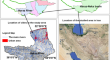
Geotechnical Characterization and PS-InSAR for Risk Analysis of Solang Landslide in Beas Valley, NW Himalaya: A Wake-Up Call!
Landslide is one of the most common occurring natural disasters in the Himalayan terrain due to its rugged topography, steep slopes, and structural...

-
GIS-based landslide susceptibility map** of Western Rwanda: an integrated artificial neural network, frequency ratio, and Shannon entropy approach
The May 2nd and 3rd, 2023 landslide in Rwanda’s Western Province caused a devastating natural disaster, resulting in the tragic loss of 95 lives....

-
Integrating predictive modeling techniques with geospatial data for landslide susceptibility assessment in northern Pakistan
The eastern road section of the China-Pakistan Economic Corridor (CPEC) traverses the challenging terrain of northern Pakistan, where frequent...
-
Effectiveness of hybrid ensemble machine learning models for landslide susceptibility analysis: Evidence from Shimla district of North-west Indian Himalayan region
The Indian Himalayan region is frequently experiencing climate change-induced landslides. Thus, landslide susceptibility assessment assumes greater...
-
Geospatial technologies for landslide monitoring: a case study of Sighetu Marmației, Romania
Landslides are a significant geological phenomenon with the potential for catastrophic consequences. There are numerous potential causes of...

-
Erosion risk map** of Anambra State in southeastern Nigeria: soil loss estimation by RUSLE model and geoinformatics
Soil erosion is a life-threatening hazard ravaging and displacing many communities in Anambra State, Nigeria. Most erosion studies in this region...

-
Integration and comparison of algorithmic weight of evidence and logistic regression in landslide susceptibility map** of the Orumba North erosion-prone region, Nigeria
In recent times, weight of evidence (WoE) and logistic regression (LR) methods in GIS-based landslide susceptibility map** (LSM) have been remarked...

-
Landslide Susceptibility Assessment Using Frequency Ratio Model in Turung Mamring, South District of Sikkim, India
The Sikkim state is part of the Himalayan hill ranges in north-eastern India, and landslide is one of the most frequent hazards in this region, which...
-
Flood susceptibility map** through geoinformatics and ensemble learning methods, with an emphasis on the AdaBoost-Decision Tree algorithm, in Mazandaran, Iran
Floods, as natural disasters, impose significant human and financial burdens, necessitating stringent mitigation measures. The recurrent annual...
-
Landslides Inventory of Active Ramgarh Thrust Zone Through Image Processing and GIS Techniques in Sikkim, India
Landslide is a widespread hazard in the Himalayan region that occurs during the monsoon season due to heavy rainfall. The seismicity in the active...
-
Assessment of the influence of physical and seismotectonic parameters on landslide occurrence: an integrated geoinformatic approach
Landslide is a devastating natural hazard, which causes significant losses of human lives and properties. The landslide occurrences are the perennial...
-
Landslides in Higher Education Curricula and Beyond
Education is a human right and plays a decisive role in capacity building from the pre-school level to professional, under-, and postgraduate...
-
Assessing landslide susceptibility using machine learning models: a comparison between ANN, ANFIS, and ANFIS-ICA
The present study is aimed at conducting a comparative landslide susceptibility assessment in a landslide-prone subset area of the Tajan Watershed in...

-

-
Comparative Analysis of Pixel and Object Based Classification Approach for Rapid Landslide Delineation with the Aid of Open Source Tools in Garhwal Himalaya
Landslides are the natural geomorphic processes that are essential for the landscape development. Loss of tremendous amount of life, natural...
-
Rapid onset hazards, fault-controlled landslides and multi-method emergency decision-making
Numerous large-scale fragmented bedrock landslides developed along major fault system is a world-wide phenomenon, which are often characterized with...
-
Active High-Locality Landslides in Mao County: Early Identification and Deformational Rules
High-locality landslides are located on slopes at high elevations and are characterized by long sliding distances, large gravitational potential...
-
A Narrative Review of Geospatial Techniques for assessing Climate Change Impacts on Cryosphere, Geo-environmental Hazards and Risks in the Himalayan Region
Geospatial techniques provide an important tool to understand the earth surface processes and its dynamics in space and time. Under the influence of...
-
Mesoscale seismic hazard zonation in the Central Seismic Gap of the Himalaya by GIS-based analysis of ground motion, site and earthquake-induced effects
The paper describes the mesoscale seismic hazard zonation study carried out in the Central Seismic Gap of the Himalaya by integration of ground...
