Search
Search Results
-
Effect of scale and map** unit on landslide susceptibility map** of Mandakini River Basin, Uttarakhand, India
AbstractMost of the research studies on landslide susceptibility map** (LSM) in the Himalayan region consider small subsets of several...

-
Landslide susceptibility assessment in medium-scale: case studies from the major drainage basins of Turkey
Inventory, heuristic, statistical, and deterministic methods have been widely used in landslide susceptibility studies in recent years. This study...

-
A Comparative Study of Supervised Classification Methods for Investigating Landslide Evolution in the Mianyuan River Basin, China
The M s 8.0 Wenchuan earthquake of 2008 dramatically changed the terrain surface and caused long-term increases in the scale and frequency of...
-
Environmental controls on landslide size distribution in the Paraitinga River basin, SE Brazil
The analytical treatment of some of the primary environmental controls on landslides has demonstrated that the landslide size distribution in the...
-
Early landslide map** with slope units division and multi-scale object-based image analysis — A case study in the **anshui River basin of Sichuan, China
Previous studies on optical remote sensing map** of landslides mainly focused on new landslides that have occurred, but little attention was paid...
-
Reactivation and dynamic process prediction of the Woda landslide in the upper **sha River Basin, China
The ancient Woda landslide, located in the upper **sha River, China, is a reactivated landslide that poses a potential risk of further instability...

-
Influence of tectonic effects on the formation and characteristics of landslide dams on the NE Tibetan Plateau: a case study in the Bailong River Basin, China
Hazards created by the landslide damming of rivers have become common in tectonically active mountainous areas. However, it remains unclear how...

-
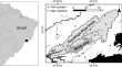
Landslide Hazard and Risk Management Framework for Alaknanda Basin in the Indian Himalayan Region
Landslides in the Indian Himalayan Region (IHR) primarily result from extreme precipitation events, distinctive topography, and inadequate soil and...
-
Landslide susceptibility assessment using different rainfall event-based landslide inventories: advantages and limitations
The present work aims to evaluate potential sources of uncertainty associated with rainfall-triggered event-based landslide inventories within the...

-
The influence of land use and land cover change on landslide susceptibility in the Lower Mekong River Basin
The Lower Mekong River Basin in Southeast Asia experiences frequent rainfall-triggered landslides especially during the monsoon season. In this...

-
Effects of Tectonic Setting and Hydraulic Properties on Silent Large-Scale Landslides: A Case Study of the Zhaobishan Landslide, China
Unlike strong earthquake-triggered or heavy rainfall-triggered landslides, silent large-scale landslides (SLL) occur without significant triggering...

-
Joint InSAR and discrete element numerical simulation method for landslide identification and monitoring: a case study of the Gongjue landslide, **sha River, China
The river-blocking landslide disasters are widely distributed in the mountainous areas of southwest China, characterized by high-elevation...

-
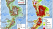
Large-scale submarine landslide in the Cochin offshore region, southwestern continental margin of India: a preliminary geophysical understanding
Analysis of high-resolution multibeam bathymetry, sub-bottom profiles, and multichannel seismic reflection data provides a novel understanding of a...

-
Exploring performance and robustness of shallow landslide susceptibility modeling at regional scale using different training and testing sets
This study aimed to examine the influence of the random selection of landslide training and testing sets on the predictive performance of the shallow...
-
A methodological framework of landslide quantitative risk assessment in areas with incomplete historical landslide information
Landslide risk assessment (LRA) is of great significance to hazard prevention and mitigation. However, the historical landslide information is...
-
Coseismic landslide sediment increased by the “9.5” Luding earthquake, Sichuan, China
The “9.5” Luding earthquake (Ms 6.8), which occurred on September 5, 2022, has triggered thousands of landslides, and caused coseismic landslide...
-
Estimation of Shallow Landslide Susceptibility Incorporating the Impacts of Vegetation on Slope Stability
This study aimed to develop a physical-based approach for predicting the spatial likelihood of shallow landslides at the regional scale in a...

-
Stability and deformation of ** landslide in Gansu, China
Information about the long-term spatiotemporal evolution of landslides can improve our understanding of the landslide development process and can...
-
Machine learning and landslide studies: recent advances and applications
Upon the introduction of machine learning (ML) and its variants, in the form that we know today, to the landslide community, many studies have been...

-
Image compression–based DS-InSAR method for landslide identification and monitoring of alpine canyon region: a case study of Ahai Reservoir area in **sha River Basin
Interferometric Synthetic Aperture Radar (InSAR) technology is capable of detecting large areas of potentially unstable slopes. However, traditional...
