Search
Search Results
-
ET2Spatial – software for georeferencing of eye movement data
The paper focuses on the development of an open-source utility tool for the analysis of eye-tracking data recorded on interactive web maps. The tool...

-
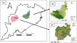
Professional LoRaWAN IoT Decentlab sensors: 1 year of data and analysis within the experimental project of meteorological monitoring in the Regional Forest of Pian Cansiglio (north-east region of Italy)
Within the experimental project of meteorological monitoring in the Regional Forest of Pian Cansiglio (mountain Regions of Veneto and Friuli Venezia...

-
A Geo-Data Science Method for Assessing Unconventional Rare-Earth Element Resources in Sedimentary Systems
Rare-earth elements (REEs) supply raw materials that constitute many of our modern critical infrastructure, defense, technology, and electrification...

-
Simulating crop yield estimation and prediction through geospatial data for specific regional analysis
Geospatial imagery play a key role in deciding land usage for agrarian planning and assessment by acknowledging the food security problems, impacts...

-
Big data analytics for seismic fracture identification using amplitude-based statistics
Present-day innovations in seismic acquisition tools and techniques have enabled the acquisition of detailed seismic datasets, which in many cases...

-
Data reinforcement control technique-based monitoring and controlling of environmental factors for IoT applications
In recent years, environmental monitoring is essential to minimize environmental problems. However, the need for more and more aquatic ecosystems...

-
Transforming petroleum downstream sector through big data: a holistic review
Big data refers to store, manage, analyze, and process efficiently a huge amount of datasets and to distribute it. Recent advancements in big data...

-
Detection of spatial and temporal precipitation patterns using remotely sensed data in the Paranapanema River Basin, Brazil from 2000 to 2021
Precipitation is the major input of the hydrological cycle in tropical regions. Changes in the spatial and temporal patterns of precipitation should...

-
Candidate wells selection and ranking based on data mining and multi-criteria decision analysis techniques
Different well productivity methodologies have been used by oil companies to improve oil recovery from mature fields. The candidate wells selection...

-
Groundwater recharge processes in the Lake Chad Basin based on isotopic and chemical data
The Lake Chad Basin is Africa’s largest endorheic basin. Because water supply for the rural population and most of the urban population depends on...

-
Machine learning prediction of climate-induced disaster injuries
The frequency of climate-induced disasters (CID) has exhibited a fivefold increase in the last five decades. In terms of CID global impact, around...

-
Comparative study of homogeneous ensemble methods with conventional ML classifiers in litho-facies detection using real-time drilling data
The drilling operation is known to be influenced by the formation’s lithology. Real-time prediction of formation parameters is essential to steer the...

-
Exploring tourism networks in the Guangxi mountainous area using mobility data from user generated content
Tourism-led economic growth and tourism-driven urbanization have attracted increasing attention by provinces and regions in China with abundant...
-
Detecting Soil pH from Open-Source Remote Sensing Data: A Case Study of Angul and Balangir Districts, Odisha State
Soil sampling, collection, and analysis are a costly and labor-intensive activity that cannot cover the entire farmlands; hence, it was conceived to...
-
Integration of ASTER and Soil Survey Data by Principal Components Analysis and One-Class Support Vector Machine for Mineral Prospectivity Map** in Kerkasha, Southwestern Eritrea
This study evaluates the potential for mineral prospectivity map** (MPM) within the Kerkesha area, southwestern Eritrea, using remote sensing and...
-
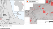
Exploring a landslide inventory created by automated web data mining: the case of Italy
Nowadays, several systems to set up landslide inventories exist although they rarely rely on automated or real-time updates. Mass media can provide...

-
Notes on Artificial Intelligence and Big Earth Observation Data for the Study of the Human Past
In the recent decades, the availability of Earth Observation technologies (from satellite, aerial and ground) for the study and preservation of the...
-

-
A Method for Determining the Sulfur Isotope Composition in Ultramafic–Mafic Rocks with a Low Sulfur Content
AbstractA method of sample decompounding and silver sulfide precipitation for determination of the sulfur isotope composition using mass-spectrometry...

-
Sustainable water planning and management research in Saudi Arabia: a data-driven bibliometric analysis
The present study aims to portray the Saudi scientific literature on “Water Planning and Management (WPM)” based on the bibliometric method. The Web...
