Search
Search Results
-
Assessment of Advanced Machine and Deep Learning Approaches for Predicting CO2 Emissions from Agricultural Lands: Insights Across Diverse Agroclimatic Zones
Prediction of carbon dioxide (CO 2 ) emissions from agricultural soil is vital for efficient and strategic mitigating practices and achieving climate...

-
Active and passive seismic data integration for delineating the near-surface velocity models at Ras Samadai area, Red Sea-Egypt
Shear-wave velocity is a soil mechanical property. It is the main cause of local ground-motion amplification, and it is responsible for a large...

-
Reconstructing the trade history: provenance study of Han bronze mirrors in and out of Han China
A rapidly increasing number of bronze mirrors dated to the Chinese Han dynasty (202 BC – AD 220), known for their unique decorative patterns and...

-
Long-term shoreline and LULC change computational analysis in part of the east coast of Tamilnadu using geoinformation tools
The Cuddalore district has a long coastline, making it susceptible to cyclonic depressions, ensuing rains that bring floods and other natural and...

-
Three-dimensional undrained stability analysis of circular tunnel heading in anisotropic and heterogeneous clay: FELA, ANN, MARS, and XGBoost
The tunnel face stability in undrained anisotropic clay that has an increasing shear strength with depth is investigated by using three-dimensional...

-
Application of electrochemical methods to assess the stability and investigation of factors influencing the ancient copper-arsenic artefacts from 3rd Millennium BC
The Bazman district constitutes one of the four regions of Iranshahr in the Sistan and Baluchistan province southeast of Iran. This study examines...

-

-
Petrography and tectono-provenance of the Barail Group of rocks, Belt of Schuppen, India
The study area, a part of the Belt of Schuppen in Nagaland (India), is represented by Laisong, Jenam and Renji Formations of the Oligocene Barail...

-
Improving Drought Prediction Accuracy: A Hybrid EEMD and Support Vector Machine Approach with Standardized Precipitation Index
This work combines the Support Vector Machine (SVM) model with Ensemble Empirical Mode Decomposition (EEMD) to present a novel method for drought...

-
Hydrologic modeling and flood-frequency analysis under climate change scenario
Assessing flood frequency in a changing climate is crucial for evaluating and managing flood risk in river basins. Often, rivers lack sufficient...

-
Archaeology meets environmental genomics: implementing sedaDNA in the study of the human past
Sedimentary ancient DNA (sedaDNA) has become one of the standard applications in the field of paleogenomics in recent years. It has been used for...

-
Fluvial to estuarine facies architecture of the Late Serravallian–Early Tortonian incised valley fill in the Adana Basin, Türkiye: depositional evolution in response to sea-level change
This study describes the sedimentary facies associations of the incised valley fill deposits, which allowed the reconstruction of the Late...

-
Deceleration captured by InSAR after local stabilization works in a slow-moving landslide: the case of Arcos de la Frontera (SW Spain)
Interferometric synthetic aperture radar (InSAR) is a remote sensing tool used for monitoring urban areas affected by geological hazards. Here we...

-
Determination of the Coseismic Displacement with PPP Wavelet Decomposition and InSAR
The 2019 northeast Ridgecrest earthquakes occurred on July 4th and July 6th with magnitudes of 6.3 and 7.1 on the Moment Magnitude Scale (Mw),...

-
Spatial modeling under small sample sizes in unconventional sweet-spots map** using spatial copula
Sweet-spots map** (SM) mainly focused on searching prospective areas that have the highest potential. However, the accuracy of SM is typically...

-
Innovative approaches for predicting seismic stability of circular and rectangular tunnels in cohesive-frictional soils using machine learning and finite element limit analysis
This paper investigates the stability solutions for plane-strain circular and rectangular tunnels in cohesive-frictional soils using the Mohr-Coulomb...

-
A numerical simulation of slope stability with nailing and shotcreting techniques on natural ground
The nailing system is a commonly utilized method for stabilizing the diaphragm walls created by excavations and natural or artificial slopes. This...

-
Numerical simulation of aeration impact on the performance of a-type rectangular and trapezoidal piano key weirs
One of the challenges associated with Piano Key Weirs (PKWs) is the nappe oscillation of the flow passing over them. Aeration of the flow has been...

-
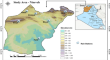
Spatiotemporal analysis of extreme climate indices in Nineveh Governorate, northern Iraq: four decades study from 1981 to 2022 using NASA-Power dataset
Understanding the dynamics of climate regimes and related extreme indices is crucial to addressing the influence of climate pattern changes and...
-
Sustainable Water Resources Management through Disaggregated Multi-Region Virtual Water Flow and Interaction Analysis
Virtual water transfer is considered as an important pathway to alleviate water shortage in arid regions due to limited water resources and...
